3D cable detection georadar: faster, safer, more precise
Three-dimensional mapping of underground cable and pipe infrastructure is now possible in a non-destructive and precise manner without having to tear up the roads. We store the data accurately and seamlessly in your planning and documentation system.
-
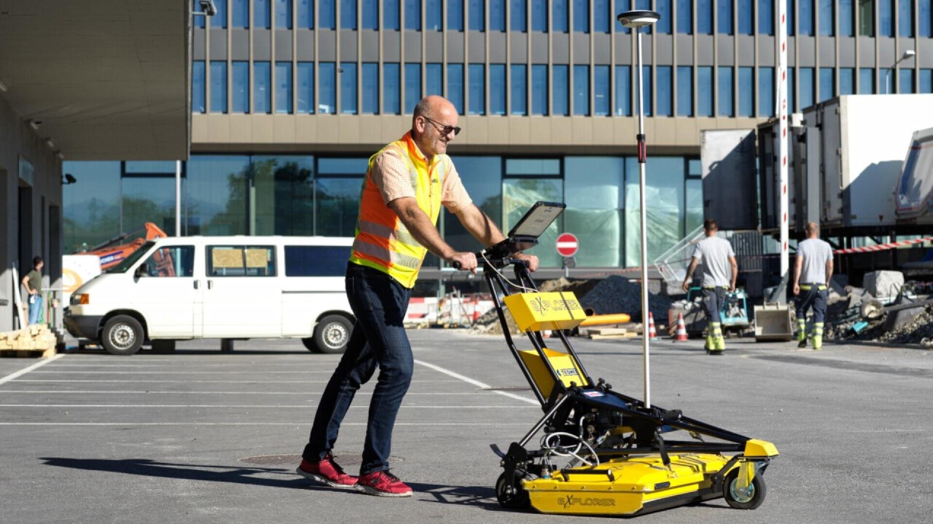
Georadar locates the pipes and buried cables underground -

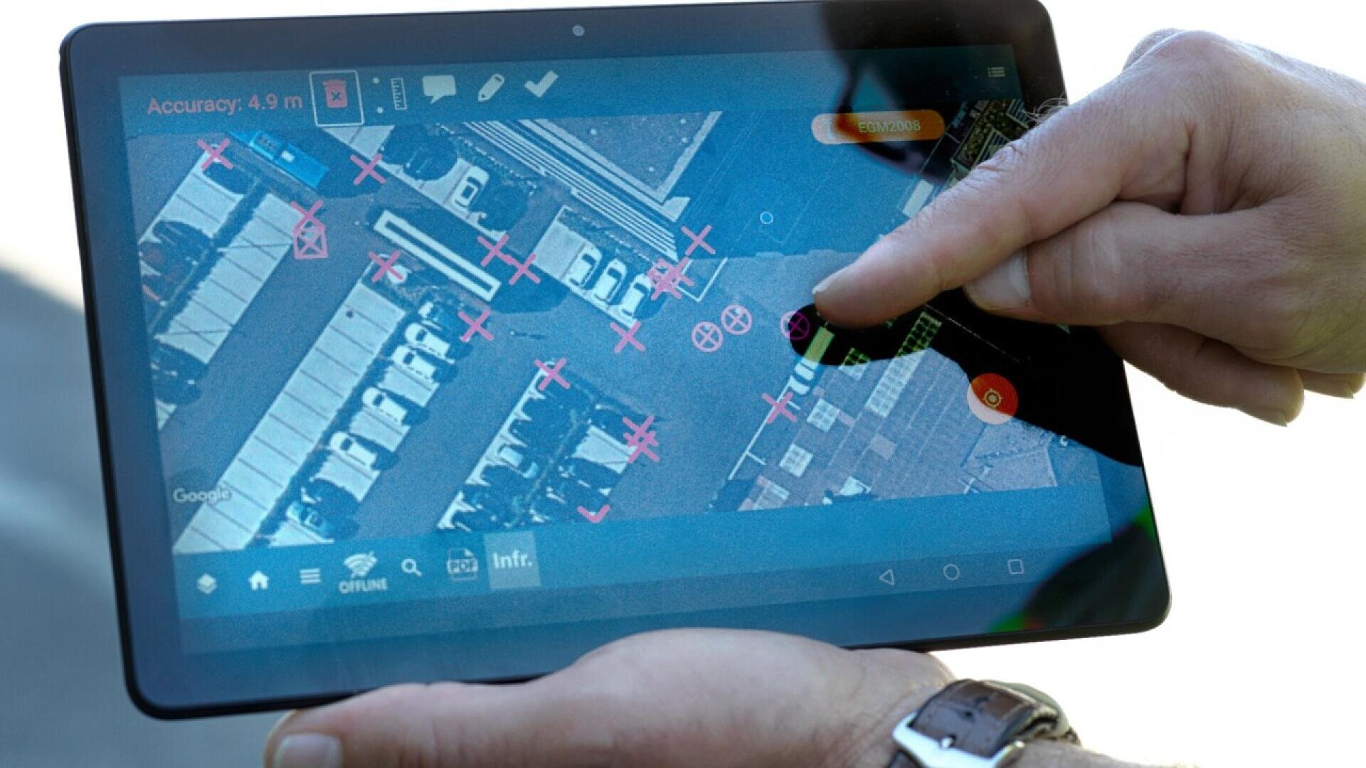
Georeferenced data analysis -
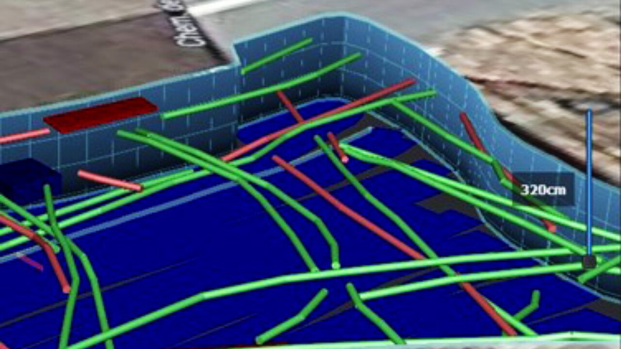
Device monitor: EPT tracking mode


Technology of the future
With our Georadar by Helltec, we use electromagnetic waves to search the subsurface for cables in existing infrastructure. Conventional soundings are no longer necessary. The measuring device detects metal, concrete and plastic pipes in water, gas, telecommunications and energy supply networks, as well as underground electrical and fibre optic cables.
On-site measurement
Our georadar locates underground pipes and buried cables using electromagnetic signals with an accuracy of +/- 2 centimetres and down to a depth of 1.8 metres. The all-terrain vehicle with laptop and touchscreen can drive on almost any surface thanks to a height-adjustable platform and record the subsurface to a width of one metre.
Georadar has 32 antennas and can be operated at a speed of up to 5 km/h. Before the actual field surveys are carried out, the surface situation is recorded using GPS and the measurement profiles are marked out. This defines a grid, which is then systematically travelled over with the georadar device. The two-dimensional radar programmes derived from this are displayed on the monitor in the form of a greyscale image.
Georeferenced data evaluation
The raw data is analysed in several steps using post-processing software. The entire documentation is processed and transferred with various detailed views, data and coordinates in three-dimensional dwg files with an additional site plan according to the customer's requirements.
The generated data can be mapped in georeferenced CAD files in 3D, processed in AutoCAD, linked to GIS systems or integrated into Google Maps. The result is precise, seamless, three-dimensional plant documentation tailored to your customer's needs.
Multiple benefits
The measurements simplify planning, construction and documentation processes and enable work relating to pipeline infrastructure to be carried out not only quickly and safely, but also precisely, cost-effectively and ecologically. Infrastructure owners, developers and contractors benefit from this, both in the run-up to construction and network planning and after construction work has been completed for documentation purposes.